Around 09.00 the big yellow bus, magnet to all children under the age of 5, arrived. Our group piled into it, luggage underneath providing ballast (hahaha – well, if any of the rivers we crossed were higher, perhaps that would have been its role!) Sólveig “Sólla” Pétursdóttir introduced herself as our guide for the the trip, to be assisted for a couple of days by Valdí. We also met our intrepid and talented driver, Sveini, who had over one million miles of safe driving under his professional belt. You will see evidence of the conditions he drove in throughout this blog.
Over rolling hills and the first large-scale signs of the geothermal power that fuels this island (which, by the way, allow the most blissful long-as-you-want hot showers) became apparent. Across some very craggy lava were tall towers of white steam, scattered irregularly along the hillsides. For some idea of how the Icelanders use geothermal energy, here is the website for Orkuveita Reykjavíkur (in English) -
http://www.or.is/Forsida/ABOUTREYKJAVIKENERGY/ReykjavikEnergy/On the other side of the road was their very effective public service announcement about safe driving – an utterly destroyed SUV up on a platform, ex post meeting of steel, lava and more steel at a high rate of speed. As we found out later in the day, one must pay attention to the roadsigns.
Blindhæð - blind hill – slow down. Change from paved road to dirt – slow down. Narrow roads – please be careful. "
!"sign means you'd better have been paying attention because there's a big change in the road you'll need to adapt to RIGHT NOW!
Seljalandsfoss, our first officieal waterfall, promised some interesting dynamics as it fell 65 m from a cliff that was recessed enough to walk behind it. Depending on the wind and air currrents generated in that cove, you could get misted or quite wet. The path was slippery but standing behind the waterfall was well worth the extra care taken with footing. The curtain of water provided a partial curtain to the parking lot but the cove we stood in briefly amplified the different languages of all the tourists - Japanese, German, French - as they walked by in wonder.
Just down the road a bit was Skógafoss, 62 m. Quite alot of water flowed over it and although we heard about the legend of the treasure that was supposed to be hidden behind the falls, it didn't seem an easy task to take on. We climbed to the top of something like 385 steps to peer over the edge of the falls and try to see where the water crashed at the bottom, but it was too high.


Time for our first Icelandic lunch on the road - ýsa, a dried haddock, rauðurbrauð (red bread) that was moist and mildly spiced, a little like ginger bread, and I was introduced to an ice tea that was made with kibbled tea and sugar bits. Of course, those from the land where tea has always been imbibed and never thrown into a harbor thought the idea of iced tea rank, but this concoction wasn't too bad. Not very strong, and probably wouldn't hold its own in a 105 F Texas summer day, but travel is always full of interesting gastronomic discoveries! (For a loving recollection of sweet iced tea check out
http://www.slate.com/id/2171917/nav/tap3/) The dried haddock was very good and I ate it on several occasions.
Sólla continued with her descriptions of the areas we drove through on our way towards the southernmost tip of the mainland. As we crossed over a river, she said, "In case you think someone has been farting, they have not been - it's the river." Indeed it had been. We could see the SSW long leg of Mýrdalsjökull, which is currently retreating at a rate of 100 m a year, on our left and the North Atlantic on our right. Already we could note a difference in the topography as we approached the Mýrdalssandur sand plains.
We stopped to take a short walk to see the sea stacks off the black lava beach at Reynisdrangur, and we treated to the sight of zillions of puffins flying around and landing within camera range! They have a funny little choppy way of flying as if their wings aren't quite long enough to keep them aloft, especially with that colorful beak leading the way.
 (Photo courtesy of Simon K. Leung)
Looking to the west gave us a peek through Dyrhólaey, the doorway.

This was also the first time we saw the hexagonal basalt columns in nature, and they were absolutely stunning.


Two columns just offshore resembled giant stone trolls, and tales were told about their being caught in sunlight and subsequently turned to stone. I think trolls really pushed their luck in Iceland; there were many huge rocks all over the country that looked troll-ish. And maybe they just couldn’t tell time.

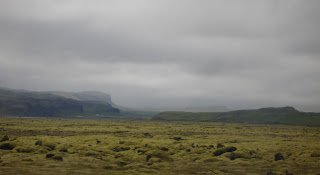
Speaking of time, we were now crossing the sandur, terrain that has been ravaged over and over throughout the literal formation of Iceland. The latest natural disaster in the area that changed the landscape was the jökulhlaup of 1996, when sub-glacial volcano Grimsvötn erupted under the Vatnajökull icecap. Some of us watched a video of this glacial burst where torrents of water that had been melted and displaced by the magma flow scoured the landscape, tearing enormous icebergs from the edge of the glacier. These icebergs then tumbled in the floodwaters, taking out parts of the Ring Road and a major bridge. An interesting scene showed bulldozers breaking apart these 2- and 3- story icy edifices. What was in place now were hummocks of chunky lava, some covered with a grey-green moss, and very flat flood plains that appeared to have many different channels leading to the Atlantic. Not exactly beachfront property, but very fascinating!
We arrived at Skaftafell National Park and had a quick lesson tent-raising from Valdí. “You’ll see what poles go together and this is how it goes up!” We also soon realized the value of a mallet to drive the tent stakes into the glacially-landscaped rocky ground.

This was our introduction to the importance of having 4 – 50 Isk coins – the showers! Since I had no change the first day I managed with VERY cold water from a sink in the WC and got a TOTAL brain freeze when I washed my hair with water fresh from the glacier!


 I thought the reindeer burger was delicious and much milder yet tastier than venison. Many pictures drawn by children were on the walls and this one caught my eye - the writing says "Hann á að láta mig fá hamborgarar" - "He is going to turn me into hamburger". Sólla bought groceries for the next several days in the nearby grocery store where there was a cold room for vegetables and fruits and a separate one for meats. We took many boxes of supplies out to the bus. The liquor prices were indeed steep so some of us decided to either go with what was familiar or with what we couldn't get in our own countries - Bud Var, Icelandic beers (Viking, Egils Ales).


 I think there must have been a discussion about keeping up the yardwork at this church because then Greg brought up something called the Hover Mower. After traveling with Greg for all of 2 days, I had a feeling he was pulling my leg. I had - and still have never - heard of the Hover Mower, that moves along the contour of the lawn on a cushion of air. I mean, I'm sorry, but it sounded too fantastic to me...but of course I have pulled up almost all the grass in my lawn and planted perennials, roses, trees, so lawnmowers rarely come into my consciousness. And of course, there was the very prominent aspect that this was something out of Greg's imagination, something just to pull out of the blue and try to fool me with. Well, I queried others in the group before Greg had a chance to give them a wink-wink-nudge-nudge that he was playing a joke on me, and I FOUND OUT IT WAS TRUE! There really is a Hover Mower!


 Snout of neighboring glacier across the sand.
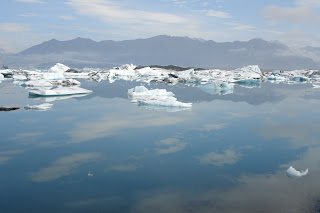
 Resting after lunch by an icy stream before the last jaunt to the lagoon formed from the glacier up ahead.

 Ben showing the group a "glacier mouse", aka stone that has gathered moss on all sides due to gentle but consistent movement of the glacier.
 OK, I took this picture as we were walking - didn't have time to aim better, and I also didn't want to fall into this crevasse!


 Finally we broke through this fog level to catch our first glimpse of Hvannadalshnúkur, the highest peak in Iceland at 2,119 m and have a clear view of part of the massive icecap. WOW! At this pass we turned to go up a very steep scree slope to head to the top of Kristínartíndar.
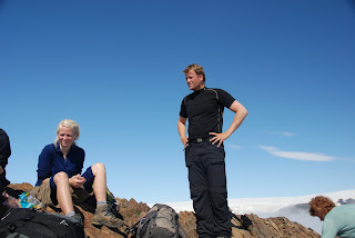
  Halfway up, though, Valdí made sure we all turned the right direction (it was a bit of a drop the other way…) After a bit of a scramble and walk along a pretty narrow edge, we found ourselves at the top with amazing views of the surrounding mountains and the icecap. Time to break out the chocolate-covered raisins, dried fruit, peanuts, cookies, and water! On the way down I heard a clattering like what I would expect of a scree rockslide - but then again not quite loud enough – and it turned out to be Valdí scree-surfing down this hill. Looked like fun, but I stuck to my steady downhill pace.
  Les Invalides with summit of Hvannadalshnúkur in background

 Cow parsley, forget-me-nots, and campanula were abundant along this last bit of the hike. Pasta for dinner, a very precious 4 minute hot shower, last-minute stretches before retiring in daylight at 23.30 under the glowing summit of Hvannadalshnúkur.


 (Photo courtesy of Simon K. Leung)


